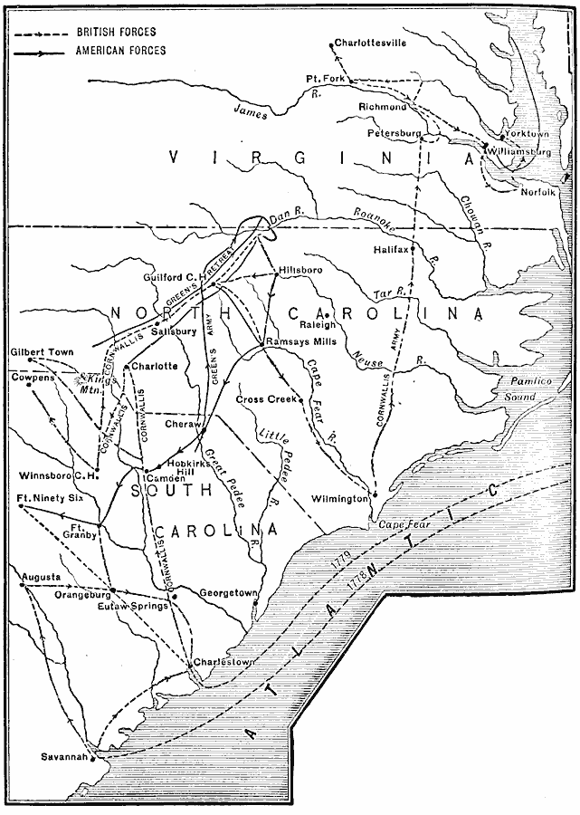
Description: A map of parts of Virginia, North Carolina, South Carolina, and Georgia involved in the southern campaigns of the American Revolutionary War (1778–1779). The map shows cities and towns, rivers and terrain, forts, and battle sites of the region, including Savannah, Charleston, Augusta, Eutaw Springs, Hobkirk's Hill, Cowpens, Gilbert Town, Guilford Courthouse, Petersburg, Williamsburg, Yorktown, and others. The map shows the British and American campaign routes.
Place Names: Early America 1400-1800, North Carolina, �South Carolina, �Virginia, �American Revolutio
ISO Topic Categories: oceans,
location,
inlandWaters
Keywords: The Campaigns in the South, political, �transportation, �historical, kAmericanRevolution, local jurisdictions, water routes,
roads, American Revolution, oceans,
location,
inlandWaters, Unknown, 1778–1779
Source: Jacques W. Redway, F.R.G.S., The Redway School History (New York, NY: Silver, Burdett and Company, 1911) 166
Map Credit: Courtesy the private collection of Roy Winkelman |
|