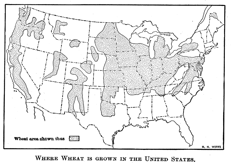
Description: A map from 1911 of the United States showing the principal wheat–growing regions of the country between 1840 and 1860.
Place Names: Agriculture, whea
ISO Topic Categories: oceans,
location,
inlandWaters
Keywords: Where Wheat is Grown in the United States, historical, �statistical, kAgriculture, agriculture, oceans,
location,
inlandWaters, Unknown, 1840–1860
Source: Jacques W. Redway, F.R.G.S., The Redway School History (New York, NY: Silver, Burdett and Company, 1911) 296
Map Credit: Courtesy the private collection of Roy Winkelman |
|