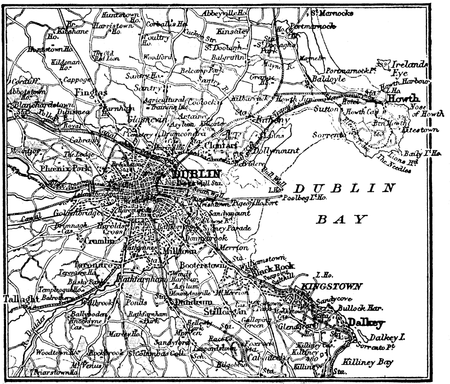
Description: A map of Dublin, Ireland, in 1914, showing major streets and roads, canals, railways, and neighboring towns. The map shows historical landmarks, Dublin Bay from Howth in the north to Dalkey in the south, the harbor walls (jetties), light house, and the River Liffey.
Place Names: Ireland, Dublin, �Dublin Bay, �Howth, �Dalkey,
ISO Topic Categories: inlandWaters,
location,
transportation
Keywords: Dublin, Ireland, physical, �transportation, physical features, inlandWaters,
location,
transportation, Unknown, 1914
Source: , The New Encyclopedic Atlas and Gazetteer of the World (New York, New York: P. F. Collier and Son, 1914) 171
Map Credit: Courtesy the private collection of Roy Winkelman |
|