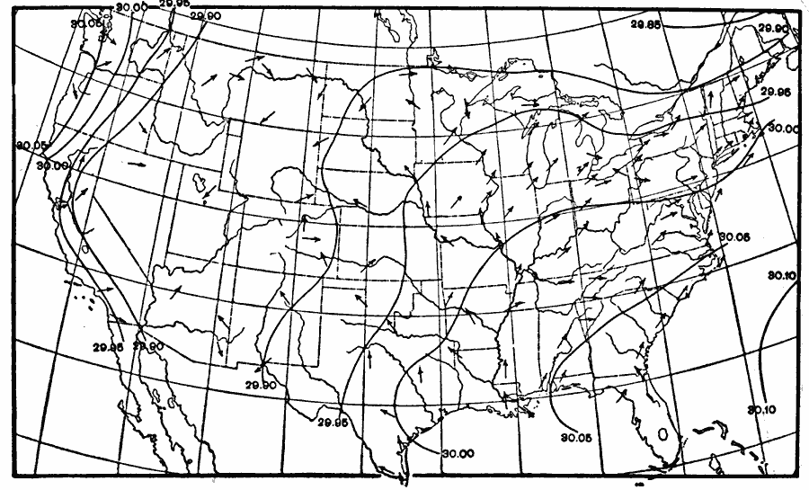
Description: A map from 1896 of the United States showing typical conditions of normal air pressure adjusted to sea level, and normal wind directions for July.
Place Names: Meteorology, wind, �air pressur
ISO Topic Categories: boundaries,
inlandWaters,
oceans
Keywords: Typical Air Pressure and Wind Direction, physical, �meteorological, kClimate, physical features, climate,
winds, boundaries,
inlandWaters,
oceans, Unknown, July 1896
Source: Frank Waldo, Elementary Meteorology (New York, NY: American Book Company, 1896) 361
Map Credit: Courtesy the private collection of Roy Winkelman |
|