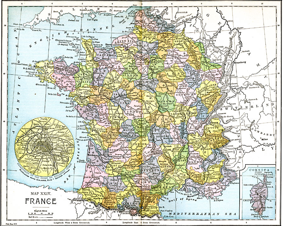
Description: A map of France in 1885, showing major cities and towns, railroads, rivers, and terrain. This map is color–coded to show the administrative Departments of France with their capitals circled. Two inset maps detail the environs of Paris and the island of Corsica.
Place Names: France, Marseilles, �Toulouse, �Bordeaux, �Geneva, �La Rochelle, �Lyons, �St. Etienne, �Nantes, �Brest, �Havre, �Pari
ISO Topic Categories: boundaries,
inlandWaters,
location,
oceans,
transportation
Keywords: France, physical, �political, �transportation, physical features, country borders,
major political subdivisions, railroads, boundaries,
inlandWaters,
location,
oceans,
transportation, Unknown, 1885
Source: John Clark Ridpath LL. D., Cyclopedia of Universal History (Cincinnati, Ohio: Jones Brothers Publishing Co., 1885) 1216-1217
Map Credit: Courtesy the private collection of Roy Winkelman |
|