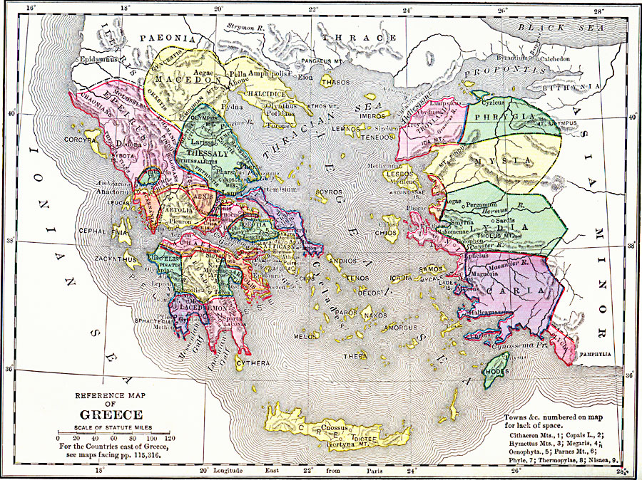
Description: A reference map of ancient Greece showing the Greek political territories of Peloponnese, the southern Balkan Peninsula, islands of the Ionian and Aegean seas, and coastal Asia Minor. A numeric reference key shows the location of the Cithaeron Mountains (1), Copais Lake (2), .Hymettus Mountains (3), Megaris (4), Oenophyta (5), Parnes Mountain (6), Phyle (7), Thermopylae (8), and Nisaea (9).
Place Names: Greece, Athens, �Chalkis, �Elefsis, �Kerkyr
ISO Topic Categories: boundaries,
inlandWaters,
location,
oceans
Keywords: Reference Map of Greece, physical, �political, kAncientGreece, physical features, country borders,
major political subdivisions, boundaries,
inlandWaters,
location,
oceans, Unknown, 1600–265 BC
Source: George Willis Botsford, Ph. D., A History of Greece (London, : The Macmillan Company, 1912) x
Map Credit: Courtesy the private collection of Roy Winkelman |
|