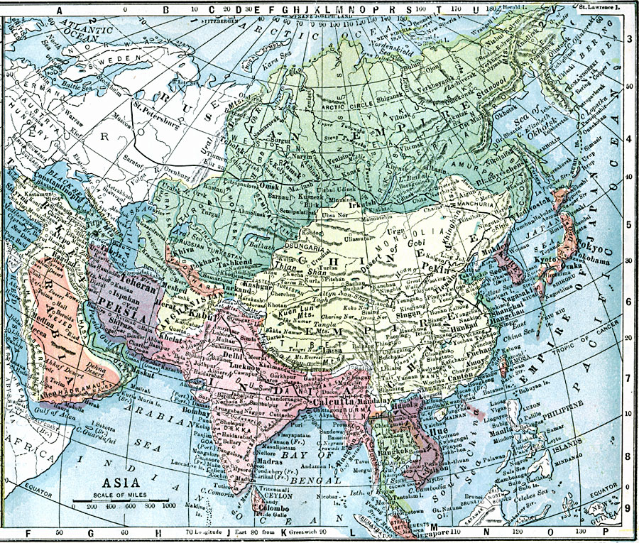
Description: A map of Asia from 1903 showing country boundaries at the time, major cities, railroads, rivers, lakes, terrain, and coastal features. This map shows the Trans-Siberian Railway from Saint Petersburg to Vladivostok, the extent of the Turkish Ottoman Empire in Asia, and the Great Wall of China.
Place Names: A Complete Map of Asia, Phillipines, �Russia, �Thailand, �China, �India, �Japan, �Persia, �Arabia, �Afganistan, �Palestine,�Arabia, �Anam, �Burma
ISO Topic Categories: transportation,
inlandWaters,
location,
oceans,
boundaries
Keywords: Asia, physical, �political, �transportation, physical features, country borders, roads, transportation,
inlandWaters,
location,
oceans,
boundaries, Unknown, 1903
Source: W. R. Hearst, The American Almanac, Yearbook Cycopedia and Atlas 2nd ed (Chicago, IL: Hearst's Chicago American, 1903) 241
Map Credit: Courtesy the private collection of Roy Winkelman |
|