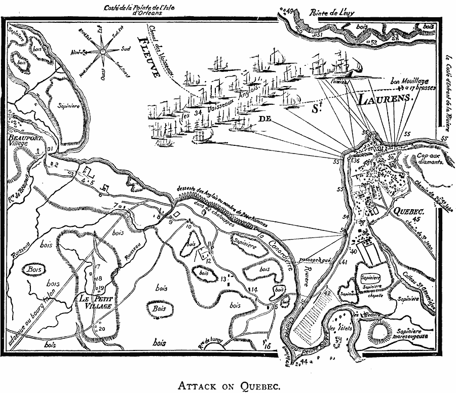
Description: A facsimile of a map showing the British attack on Quebec in 1690. The map shows the St. Lawrence River, the fortifications of the city, including the coverage and range of cannons, the 34 vessels of the British fleet and the British encampment. This map also shows terrain features, rivers, roads, agricultural lands, and neighboring villages.
Place Names: Canada, Quebe
ISO Topic Categories: oceans,
location,
inlandWaters
Keywords: Attack on Quebec, borders, �physical, �historical, kEarlyMapsFacsimile, physical features, other military, oceans,
location,
inlandWaters, Unknown, 1690
Source: Justin Winsor, Narrative and Critical History of America (vol. 4) (Boston, MA: Houghton, Mifflin, and Company, 1884)
Map Credit: Courtesy the private collection of Roy Winkelman |
|