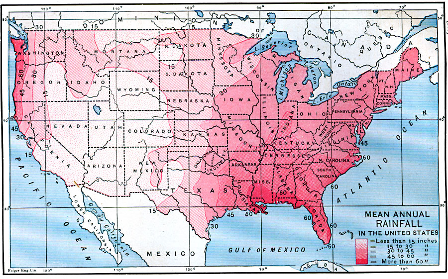
Description: A map from 1888 of the United States showing the mean annual rainfall distribution for the region. The map is color–coded to show rainfall ranging from less than 15 inches to more than 60 inches.
Place Names: Meteorology, rainfal
ISO Topic Categories: climatologyMeteorologyAtmosphere,
inlandWaters,
location,
oceans
Keywords: Mean Annual Rainfall in the United States, physical, �meteorological, kClimate, kPrecipitation, physical features, rainfall, climatologyMeteorologyAtmosphere,
inlandWaters,
location,
oceans, Unknown, 1888
Source: Russell Hinman, Eclectic Physical Geography (Cincinnati, OH: Houghton Mifflin Company, 1888) 307
Map Credit: Courtesy the private collection of Roy Winkelman |
|