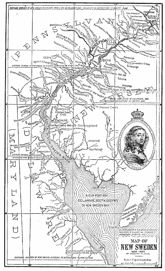
Description: A map of New Sweden (1638–1655) from an article by Gregory Keen (1878) showing Cape May and Cape Henlopen, the Delaware Bay and the Delaware River (New Sweden River) north to Trenton, New Jersey, including Philadelphia and Bristol. The map shows boundaries of the Swedish land claims, the Dutch settlements and forts, Swedish settlements, rivers and tributaries. The map gives both original names and current names for many settlements, with dates of establishment.
Place Names: Early America 1400-1800, Delaware, �Maryland, �New Jersey, �New York, �Pennsylvania, �Discovery, �Colonial America, �New Sweden, �Dutch, �Swedes, �New Netherlan
ISO Topic Categories: oceans,
location,
inlandWaters
Keywords: New Sweden, borders, �physical, physical features, oceans,
location,
inlandWaters, Unknown, 1638–1655
Source: Justin Winsor, Narrative and Critical History of America (vol. 4) (Boston, MA: Houghton, Mifflin, and Company, 1884) 501
Map Credit: Courtesy the private collection of Roy Winkelman |
|