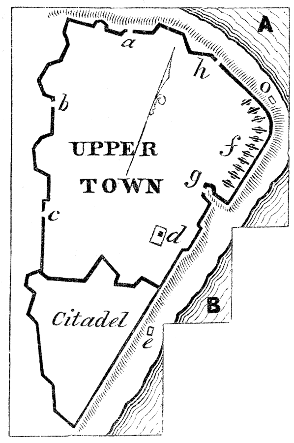
Description: Explanation of the diagram. A is the St. Charles River; B, the St. Lawrence; a is Palace Gate; b, Gate St. John's; c, Gate St. Louis; d, Governor's Garden; e, the portion of Cape Diamond at the foot of which Montgomery was killed; f, the grand battery; g, Prescott Gate; h, Hope Gate; o is a bold point of rock in the Sault-au-Matelot, where Arnold was wounded. — Pictorial Field-Book of the Revolution Vol. I
Place Names: Canada, St. Charles River,�St. Lawrence River, �Quebe
ISO Topic Categories: inlandWaters,
location,
structure
Keywords: Point Levi, Quebec, inlandWaters,
location,
structure, Unknown, 1770s
Source: Benson J. Lossing, Pictorial Field-Book of the Revolution Vol. I (New York, NY: Harper and Brothers, 1851) 183
Map Credit: Courtesy the private collection of Roy Winkelman |
|