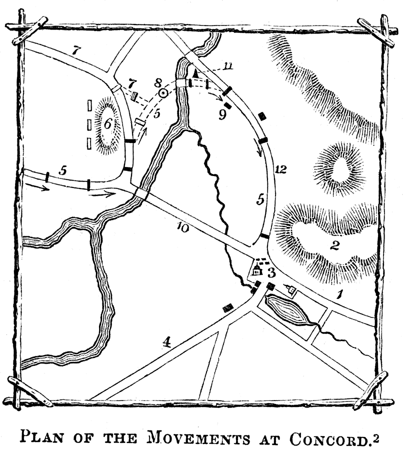
Description: A plan of the Battle of Concord, Massachusetts, at the opening of the American Revolutionary War (April 19, 1775). Explanation of the Plan: (1) Lexington Road; (2) Hills and high land where the liberty pole stood; (3) center of the town, and main body of the British; (4) Road to the South Bridge; (5) Road to the North Bridge and to Colonel Barnett's, two miles from the center of the town; (6) High ground a mile north of the meeting–house, where the militia assembled; (7) Road along which they marched to dislodge the British at North Bridge; (8) Spot where Davis and Hosmer fell; (9) Reverend Mr. Emerson's house; (10) Bridges and roads made in 1793; (11) the monument; and (12) is the place where re–enforcements met Captain Parsons. — Pictorial Field-Book of the Revolution Vol. I, 1851.
Place Names: Massachusetts, Concord,
ISO Topic Categories: inlandWaters,
location
Keywords: Plan of the Movements at Concord, physical, �historical, kBattle, physical features, American Revolution, inlandWaters,
location, Unknown, 1775
Source: Benson J. Lossing, Pictorial Field-Book of the Revolution Vol. I (New York, NY: Harper and Brothers, 1851) 527
Map Credit: Courtesy the private collection of Roy Winkelman |
|