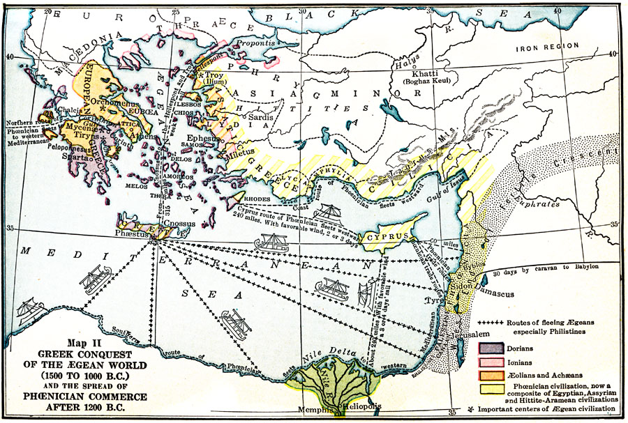
Description: A map of the Eastern Mediterranean World between1500–1000 BC, showing the extent of the early Greek civilization in the and the spread of Phoenician commerce after 1200 BC. This map is color–coded to distinguish between Dorian, Ionian, Aeolian and Achaean Greeks, and Phoenician civilizations. Important centers of &Aelig;gean civilization are shown, with estimated time of travel by ship and overland routes given between trade centers.
Place Names: Regional Mediterranean, Assyria, �Crete, �Cyprus, �Damascus, �Israel, �Jerusalem, �Memphis, �Phrygi
ISO Topic Categories: borders, �physical, �transportation, kWorldMedSea, kWorldEurasia
Keywords: Greek Conquest of the Aegean World and the Spread of Phoenician Commerce, borders, �physical, �transportation, water routes, borders, �physical, �transportation, kWorldMedSea, kWorldEurasia, Unknown, 1500 BC
Source: James Henry Breasted, Ph.D., LL.D., Ancient Times - A History of the Early World (Boston, MA: Ginn and Company, 1916)
Map Credit: Courtesy the private collection of Roy Winkelman |
|