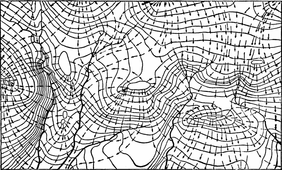
Description: A diagram from 1911 showing the effect of land contour on the flow direction of groundwater within a typical water table in a hilly region. The continuous lines represent landscape contour lines, the heavy black lines represent surface drainage (stream flow), and the dashed lines represent the direction of motion of groundwater within the subsurface water table.
Place Names: Map Drawing,
ISO Topic Categories: elevation,
geoscientificInformation
Keywords: Contour Map of a Water Table, physical, �hydrological, physical features,
geological, water table,
currents, elevation,
geoscientificInformation, Unknown, 1911
Source: Isaiah Bowman, Ph. D., Forest Physiography (New York, NY: John Wiley and Sons, 1911) 45
Map Credit: Courtesy the private collection of Roy Winkelman |
|