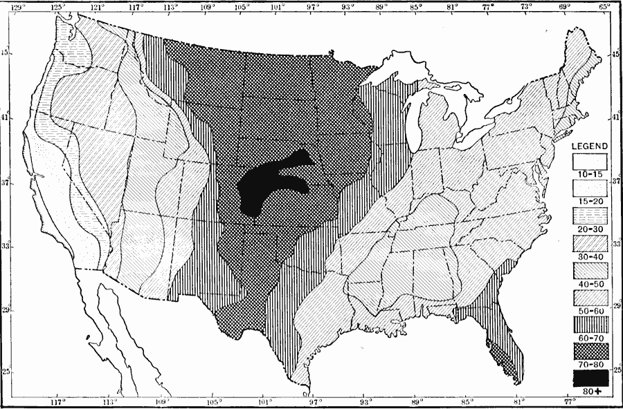
Description: A map from 1911 of the United States showing the percentage of annual rainfall received in the six warmer months, April to September inclusive.
Place Names: Meteorology, rainfal
ISO Topic Categories: boundaries,
climatologyMeteorologyAtmosphere,
location,
inlandWaters,
oceans
Keywords: Annual Rainfall Percentage in Summer Months, physical, �political, �meteorological, kClimate, kPrecipitation, physical features, country borders,
major political subdivisions, rainfall, boundaries,
climatologyMeteorologyAtmosphere,
location,
inlandWaters,
oceans, Unknown, 1911
Source: Isaiah Bowman, Ph. D., Forest Physiography (New York, NY: John Wiley and Sons, 1911) 120
Map Credit: Courtesy the private collection of Roy Winkelman |
|