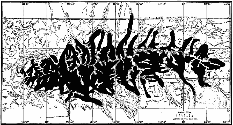
Description: A map showing the glacier systems of the Uinta Mountains during the Pleistocene. Solid black represents the area covered by later glaciers, while the combined solid black and dotted represent the extent of area covered by earlier glaciers.
Place Names: Utah,
ISO Topic Categories: boundaries,
geoscientificInformation,
inlandWaters,
location
Keywords: Uinta Glacier Systems, physical, kGlacial, physical features,
topographical, boundaries,
geoscientificInformation,
inlandWaters,
location, Unknown, 1911
Source: Isaiah Bowman, Ph. D, Forest Physiography (New York, NY: John Wiley and Sons, 1911) 348
Map Credit: Courtesy the private collection of Roy Winkelman |
|