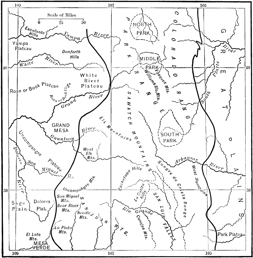
Description: A map from 1911 of the southern Rockies showing the main topographic features of the region, including; the eastern foothills (hogback topography); the Colorado or Front Range and Wet Mountains; the Park, Sawatch (or Saguache), and Sangre de Cristo ranges; the North, Middle, South, and Huerfano chain of "Parks" (intermont basins); and the irregular mountain knots or groups of igneous origin which lie beyond the Park–Sawatch axes, such as the Elk, La Plata, San Juan, and Uncampahgre mountains. — Bowman, 1911.
Place Names: Colorado,
ISO Topic Categories: boundaries,
inlandWaters,
location
Keywords: Southern Rockies, physical, kGeology, physical features, boundaries,
inlandWaters,
location, Unknown, 1911
Source: Isaiah Bowman, Ph. D, Forest Physiography (New York, NY: John Wiley and Sons, 1911) 356
Map Credit: Courtesy the private collection of Roy Winkelman |
|