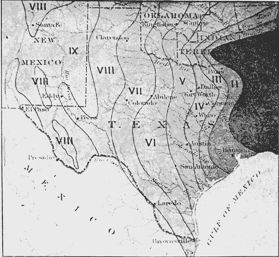
Description: A map from 1911 showing the annual mean precipitation in the Texas Region. The map is keyed to show: I, over 50 inches; II, over 45; III, over 40; IV, over 35; V, over 30; VI, over 25; VII, over 20; VIII, over 15; IX, over 10 inches.
Place Names: Texas, Santa Fe, �Colorado, �San Antonio, �Austin, �precipitatio
ISO Topic Categories: boundaries,
inlandWaters,
location
Keywords: Precipitation in the Texas Region, physical, �political, �meteorological, kPrecipitation, physical features, major political subdivisions,
country borders, rainfall, boundaries,
inlandWaters,
location, Unknown, 1911
Source: Isaiah Bowman, Ph. D, Forest Physiography (New York, NY: John Wiley and Sons, 1911) 424
Map Credit: Courtesy the private collection of Roy Winkelman |
|