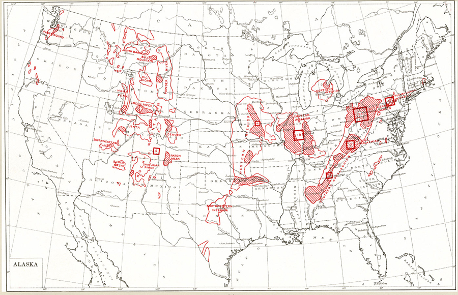
Description: "Production of coal in the United States in 1918 and outlines [in red] of coal fields... Size of block is proportional to percentage of total production of the United States in 1918; percentage indicated also by figures... Approximate outlines of coal fields other than lignite. Most important producing districts shaded." — Department of the Interior, 1921
Place Names: Minerals, Boston, �Chicago, �Houston, �Los Angeles, �New Orleans, �New York, �San Diego, �Seattle, �Washington D.C., �Tallahassee, �St. Augustine, ��coa
ISO Topic Categories: boundaries,
economy
Keywords: Production of Coal in the United States, physical, �political, �statistical, kResources, physical features,
geological, country borders,
major political subdivisions, industry,
economic, boundaries,
economy, Unknown, 1918
Source: Department of the Interior , World Atlas of Commercial Geology (Washington, DC: Department of the Interior , 1921) Plate 8
Map Credit: Courtesy the private collection of Roy Winkelman |
|