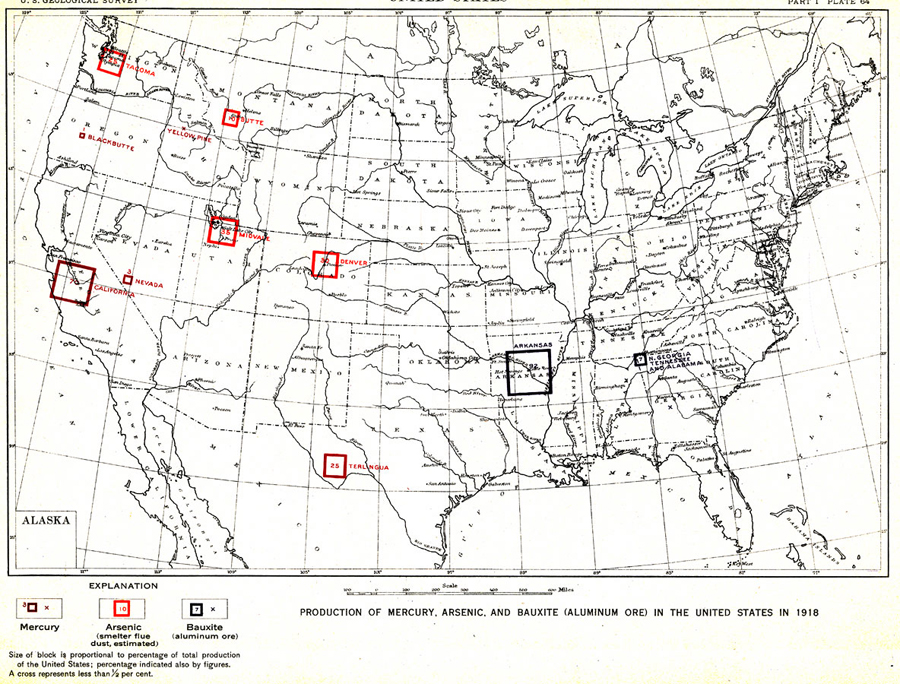
Description: "Production of mercury, arsenic, and bauxite (aluminum ore) in the United States in 1918 ...Size of block is proportional to percentage of total production of the United States; percentage indicated also by figures. A cross represents less than 1/2 per cent." — Department of the Interior, 1921
Place Names: Minerals, Boston, �Chicago, �Houston, �Los Angeles, �New Orleans, �New York, �San Diego, �Seattle, �Washington D.C., �Tallahassee, �St. Augustine, �mercury, �arsenic, �bauxite,
ISO Topic Categories: boundaries,
economy,
inlandWaters,
oceans
Keywords: Production of Mercury, Arsenic, and Bauxite in the United States, physical, �political, �statistical, kResources, physical features,
geological, country borders, industry,
economic, boundaries,
economy,
inlandWaters,
oceans, Unknown, 1918
Source: Department of the Interior , World Atlas of Commercial Geology (Washington, DC: Department of the Interior , 1921) Plate 64
Map Credit: Courtesy the private collection of Roy Winkelman |
|