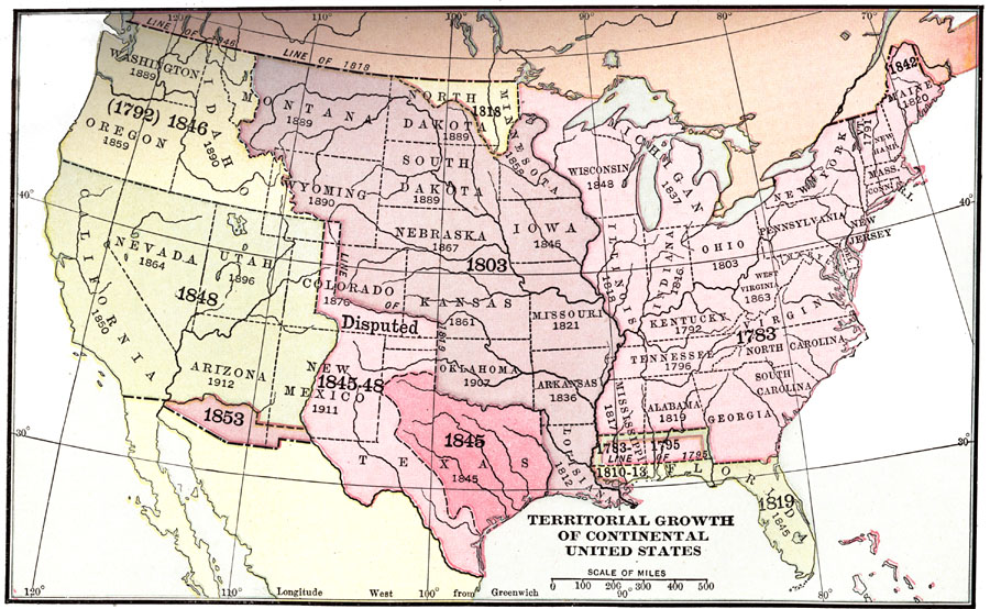
Description: A map from 1913 of the United States showing its acquisition of territory from the original states and Northwest Territory after the American Revolutionary War in 1783 to the Gadsden Purchase in 1853. The dates for each acquisition are given, as well as the dates states were admitted into the Union.
Place Names: Growth of Nation, Alabama, �Arizona, �Arkansas, �Colorado, �Connecticut, �Delaware, �Florida, �Georgia, �Idaho, �Illinois, �Indiana, �Iowa, �Kansas, �Kentucky, �Louisiana, �Maine, �Maryland, �Massachusetts, �Michigan, �Minnesota, �Mississippi, �Missouri, �Montana, �New
ISO Topic Categories: location,
inlandWaters,
oceans
Keywords: Territorial Growth of the Continental United States, growth, �historical, �physical, �physical features, historical event, location,
inlandWaters,
oceans, Unknown, 1783–1853
Source: Nathaniel Wright Stephenson, An American History (Boston, MA: Ginn and Company, 1913)
Map Credit: Courtesy the private collection of Roy Winkelman |
|