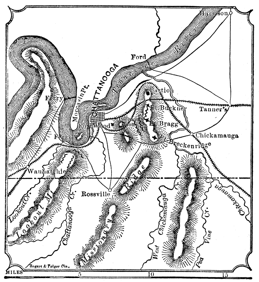
Description: "Missionary Ridge and Lookout Mountain. These two sanguinary conflicts of the civil war were fought Nov. 23–25, 1863, between Gen. Bragg, Confederate, and Gens. Hooker and Rosecrans, Federal. The latter were completely victorious, and the result was so decisive as to put an end to the war in Tenn., until it was renewed by Hood at Franklin and Nashville in the winter of 1864." — W. H. DePuy, 1881.
Place Names: Tennessee, Chattanooga, �Lookout Mountain, �Chickamauga, �Moccasin Point, �Fort Wood, �Fort Breckenridge, �Fort Bragg, �Fort Buckner, �Missionary Ridge, �Rossville, �Tennessee Rive
ISO Topic Categories: boundaries,
inlandWaters,
society
Keywords: Vicinity of Missionary Ridge and Lookout Mountain, physical, �political, �transportation, �historical, physical features,
topographical, major political subdivisions, railroads,
roads, Civil War, boundaries,
inlandWaters,
society, Unknown, 1863
Source: W. H. DePuy, People's Cyclopedia of Universal Knowledge: V.2 (New York, NY: Phillips & Hunt, 1881) 1169
Map Credit: Courtesy the private collection of Roy Winkelman |
|