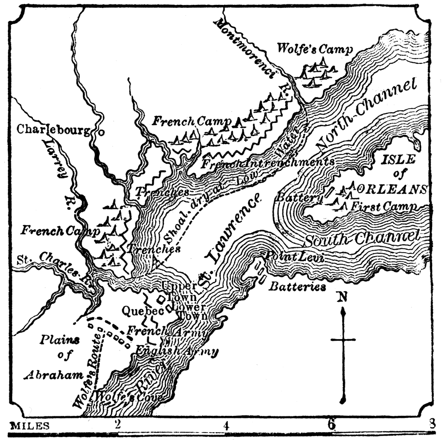
Description: "Quebec, Battle of, was fought Sept. 13, 1759, between the French, under Gen. Montcalm, and the British, under Gen. Wolfe. The battle was fought on the 'Plains of Abraham,' behind the city; it resulted in favor of the English, and virtually ended the dominion of France in Canada." — W. H. DePuy, 1881
Place Names: Canada, Quebec, �River St. Lawrence, �Plains of Abraham, �St. Charles River, �Charlebourg, �Isle of Orlea
ISO Topic Categories: boundaries,
inlandWaters,
society
Keywords: Battle of Quebec, physical, �transportation, �historical, �Wolfe's Camp, �Wolfe's Route, �French Camp, �French Intrenchments, physical features, water routes, boundaries,
inlandWaters,
society, Unknown, 1759
Source: W. H. DePuy, People's Cyclopedia of Universal Knowledge: V.2 (New York, NY: Phillips & Hunt, 1881) 1450
Map Credit: Courtesy the private collection of Roy Winkelman |
|