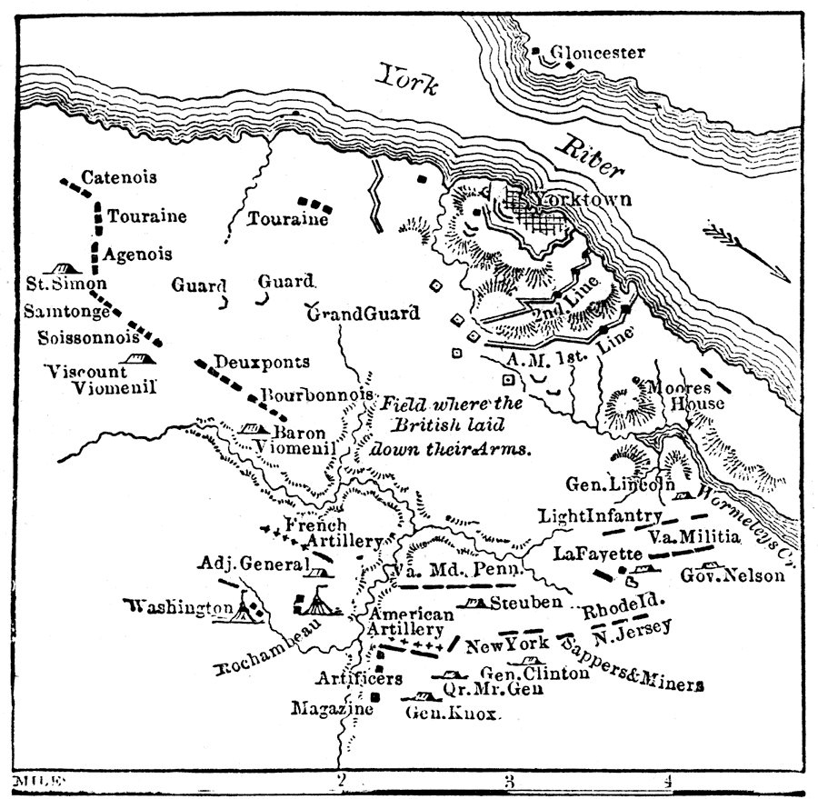
Description: "The story of the siege of Yorktown is a brief one. On Sept. 28, 1781, the allies encamped around Yorktown, and completely hemmed in Cornwallis and 7,000 men. His fleet had been so severely handled by the French that it had sailed away for New York. On Oct. 6 a brisk cannonade was opened on the British position; on the 14th the enemy's works were carried by storm: on the 17th Cornwallis proposed a surrender; terms were drawn up on the 18th, and on the 19th the entire British army laid down their arms." — W. H. DePuy, 1881.
Place Names: Virginia, Yorktown, �Gloucester, �York Rive
ISO Topic Categories: inlandWaters,
society
Keywords: Siege of Yorktown, physical, �historical, kAmericanRevolution, physical features,
topographical, American Revolution, inlandWaters,
society, Unknown, 1781
Source: W. H. DePuy, People's Cyclopedia of Universal Knowledge: V.2 (New York, NY: Phillips & Hunt, 1881) 1489
Map Credit: Courtesy the private collection of Roy Winkelman |
|