Cumberland Gap

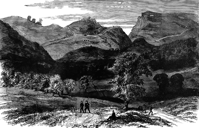
“Cumberland Gap and Heights, Tenn., from the Kentucky side. Cumberland Gap was a place of such importance during the war as to be constantly the object of operations on both sides, who indeed alternately held it. Like Harper’s Ferry, it was deemed a strategic point of great value; but the fact that no action took place, and that its evacuation was compelled by distinct movements, tend to modify this idea. It is a natural gap in a mountain, 80 miles long, or rather the only natural gap, although other points bear that name. Cumberland Gap is 150 miles southeast of Lexington, Ky. The mountain is here 1,200 feet high, but the notch is a cut nearly two-thirds of this, the road through the gap being only 400 feet high. On the southern or Tennessee side this mountain is abrupt, and in some places perpendicular, and the summit almost inaccessible, except through the gap. The northern or Kentucky side is more irregular, breaking off in a sucession of smaller mountains and hills to the Valley of the Cumberland. Our sketch shows the Kentucky side."— Frank Leslie, 1896
Source
Frank Leslie Famous Leaders and Battle Scenes of the Civil War (New York, NY: Mrs. Frank Leslie, 1896)
Downloads
2400×1556, 3.6 MiB
1024×663, 334.1 KiB
640×414, 131.6 KiB
320×207, 34.0 KiB