Peekskill Landing
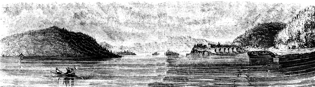
“View from Peekskill Landing. This view is from Peekskill landing, looking up the river. On the left is the Dunderberg, or Thunder Mountain, over which the troops marched to Forts Clinton and Montgomery. The dark spot on the brink of the river, upon the extreme left, shows the place of the coffer-dam made by the deluded seekers after Captain Kidd’s treasure. At the water’s edge, on the right, is seen the grading of the Hudson River railroad, in course of construction when the sketch was made. The dark mountain on the right is Anthony’s Nose. Intermediately, and projecting far into the river, is a high, sandy bluff, on which stood Fort Independence. Further on is Beveridge’s Island; and in the extreme distance, behind the flag-staff, is seen Bear Mountain. Between the point of Fort Independence and the rock cutting of the railroad is the mouth of Peek’s Kill, or Peek’s Creek."—Lossing, 1851
Galleries
1763-1788 American Revolution PlacesSource
Benson J. Lossing, The Pictorial Field-Book of the Revolution (New York: Harper & Brothers, 1851)II:166
Downloads
2400×671, 1.3 MiB
1024×286, 159.8 KiB
640×178, 63.4 KiB
320×89, 16.5 KiB