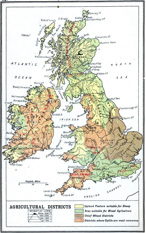
Description: A map of the British Isles from 1910 showing the agricultural districts. This map is color–coded to show the areas of upland pasture suitable for sheep, areas suitable for mixed agriculture, chief wheat districts, and districts where cattle are most numerous. Predominant crops and resources are noted in red, and important agricultural topography, such as Cheshire Plain, Salisbury Plain, the Fens, and Highlands are noted in black. Elevation contours are shown from sea level to 2500 feet, with areas above 2500 feet in solid black.
Place Names: United Kingdom,
ISO Topic Categories: inlandWaters,
location,
oceans,
elevation
Keywords: British Isles Economic - Agricultural Districts, physical, �physical features, �topographical, �statistical, �industry, kAgriculture, topographical,
physical features, industry, inlandWaters,
location,
oceans,
elevation, Unknown, 1910
Source: J.G. Bartholomew, LLD, A Literary & Historical Atlas of Europe (New York, New York: E.P. Dutton & Co., Ltd. , 1910) 52
Map Credit: Courtesy the private collection of Roy Winkelman |
|