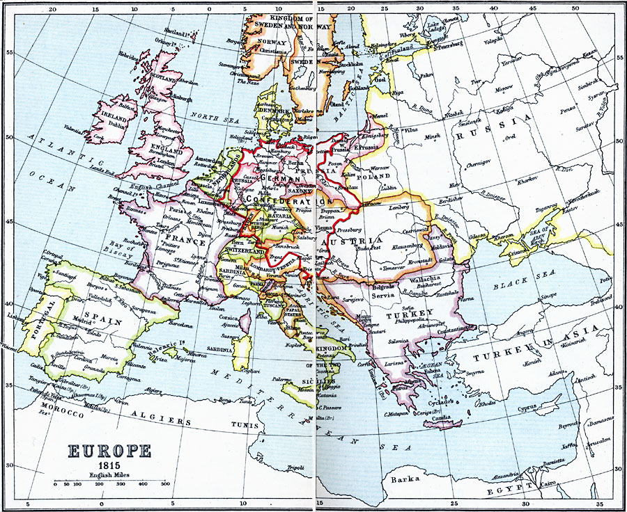
Description: A map of Europe highlighting the German Confederacy created by the Congress of Vienna in 1815, the successor to the Holy Roman Empire of the German Nation. The confederacy was made up of 39 states including portions of the Austrian Empire and the Kingdom of Prussia, Bavaria, Hesse, Baden, Württemberg, and others. This map also shows the 1815 European territories of the Kingdom of Norway and Sweden, Russia, Poland, the Ottomans in Europe, Sardinia, Lombardy–Venetia, Parma, Modena, Lucca, Tuscany, Papal States, and the Kingdom of the two Sicilies.
Place Names: A Complete Map of Europe, England, �France, �Germany, �Greece, �Italy, �Poland, �Portugal, �Romania, �Spain, �Sweden, �Turkey, �United Kingdo
ISO Topic Categories: inlandWaters,
location,
oceans
Keywords: Europe, country borders, �political, kGermanConfederacy, country borders, inlandWaters,
location,
oceans, Unknown, 1815
Source: J.G. Bartholomew, LLD, A Literary & Historical Atlas of Europe (New York, New York: E.P. Dutton & Co., Ltd. , 1910) 44-45
Map Credit: Courtesy the private collection of Roy Winkelman |
|