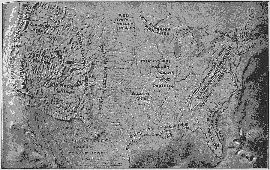
Description: A relief map from 1910 of the United States showing the physical features of the New England Highlands, Adirondacks, Appalachian Plateau and Mountains, Piedmont Plateau, Coastal Plains, Lake Superior Highlands, Red River Valley Plains, Mississippi Valley Plains and Prairies, Ozark Mountains, Great Western Plains, Rocky Mountains, Columbia Plateau, Great Basin, Colorado Plateau, Sierra Nevada, Coastal Ranges, Cascade Mountains, and the submerged Continental Shelf of the East Coast.
Place Names: A Complete Map of the United States,
ISO Topic Categories: inlandWaters,
location,
oceans
Keywords: Relief of the United States, physical, kRelief, physical features, inlandWaters,
location,
oceans, Unknown, 1910
Source: Ralph S. Tarr, B.S., F.G.S.A. and Frank M. McMurry, Ph.D., New Geographies 2nd ed (New York, NY: The Macmillan Company, 1910) 27
Map Credit: Courtesy the private collection of Roy Winkelman |
|