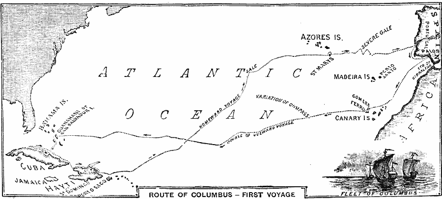
Description: A map of the North Atlantic showing the outward and homeward routes of the first voyage of Christopher Columbus to the New World. The map shows the home port of Palos, Spain (Palos de la Frontera), and the route to the Canary Islands, the landing at the island of Guanahani or San Salvador Island, his southward route to Cuba and Haiti, and homeward route to Spain. The map shows the approximate location to the east of the Azores of the storm which threatened to founder the ships on the homeward voyage.
Place Names: Regional Atlantic Ocean, Africa, �Atlantic Ocean, �Bahama Islands, �Canary Islands, �Guana, �Haiti, �Jamaica, �Madeira Islands, �Puerto Rico, �Spai
ISO Topic Categories: water route, �transportation, kWorldAtlantic
Keywords: Route of the First Voyage of Columbus, water route, �transportation, water routes, water route, �transportation, kWorldAtlantic, Unknown, 1492
Source: William Swinton, First Lessons in Our Country's History (New York, New York: American Book Company, 1894) 16
Map Credit: Courtesy the private collection of Roy Winkelman |
|