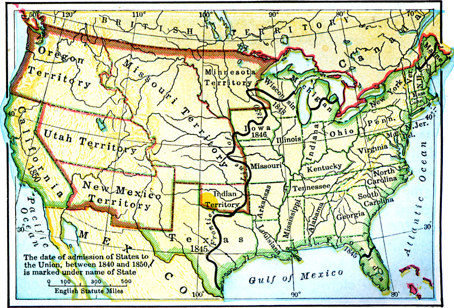
Description: A map of the United States in 1850, showing the frontier line, indicate by the thick black line. The map shows the States added to the Union between 1840 and 1850, including Florida (1845), Texas (1845), Iowa (1846), Wisconsin (1848), and California (1850). The map also shows the territories of Minnesota, Missouri, Utah, New Mexico, Oregon, and the Indian Territory (Oklahoma) at the time.
Place Names: Growth of Nation, Arkansas, �California, �Connecticut, �Delaware, �Florida, �Georgia, �Indian Territory, �Iowa, �Kentucky, �Louisiana, �Maine, �Massachusetts, �Mexico, �Michigan, �Minnesota Territory, �Missouri Territory, �New Hampshire, �New Jersey, �New Mexico Ter
ISO Topic Categories: oceans,
location,
inlandWaters,
boundaries
Keywords: The United States, borders, �historical, �physical, �physical features, historical event, oceans,
location,
inlandWaters,
boundaries, Unknown, 1850
Source: S.E. Forman, Advanced American History (New York, NY: The Century Company, 1919)
Map Credit: Courtesy the private collection of Roy Winkelman |
|