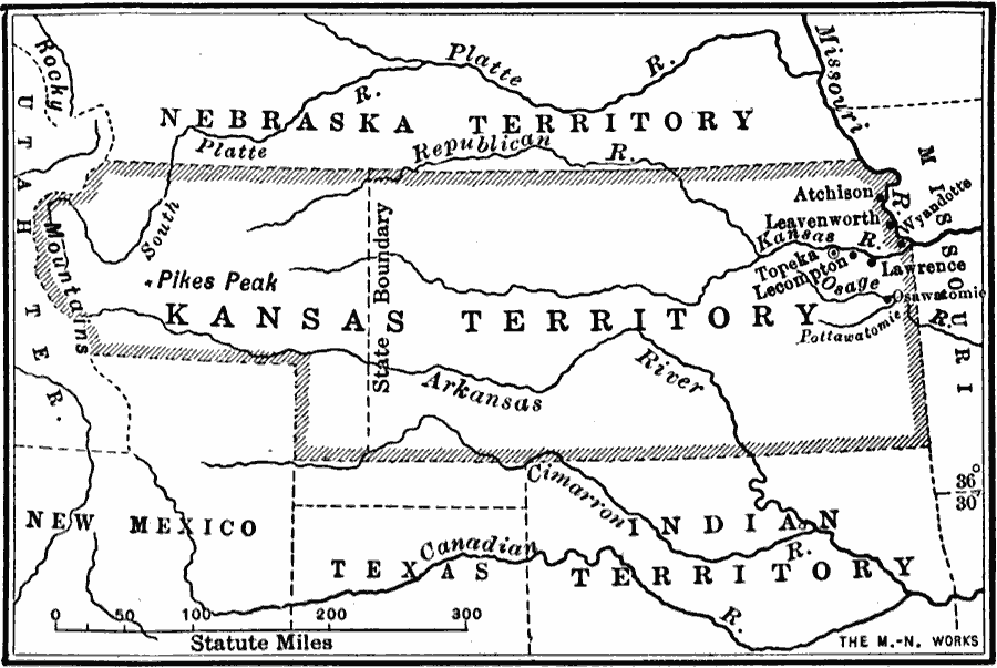
Description: A map of the Kansas Territory in 1854 showing the area of dispute over the issue of allowing slavery in the territory or abolition as a result of the Kansas–Nebraska Bill of 1854. "The Kansas–Nebraska Bill made the fertile soil of Kansas a prize to be contended for by the forces of slavery and the forces of freedom. Even before the bill became a law emigrants from the South, especially from Arkansas and Missouri, were rushing into Kansas with the purpose of making it a slave State, while emigrants from the North were hurrying to the new Territory with the purpose of making it a free State. The slave State people settled along the Missouri River and founded the towns of Atchison, Leavenworth, and Lecompton. The free State people settled along the Kansas River and founded the towns of Topeka, Lawrence, and Osawatombie." — Forman, 1919, pp. 395–396.
Place Names: Midwest States, Indian territory, �Kansas territory, �Missouri, �New Mexico, �Texas, �United States, �Utah territory, �Great Plains, �Rocky Mountain Region, �Texas, �Kansa
ISO Topic Categories: oceans,
location,
inlandWaters,
boundaries
Keywords: Scene of the struggle in the Kansas Territory, borders, �ethnological, �historical, �physical, �statistical, physical features, ethnological, historical event, oceans,
location,
inlandWaters,
boundaries, Unknown, 1854
Source: S.E. Forman, Advanced American History (New York, NY: The Century Company, 1919) 395
Map Credit: Courtesy the private collection of Roy Winkelman |
|