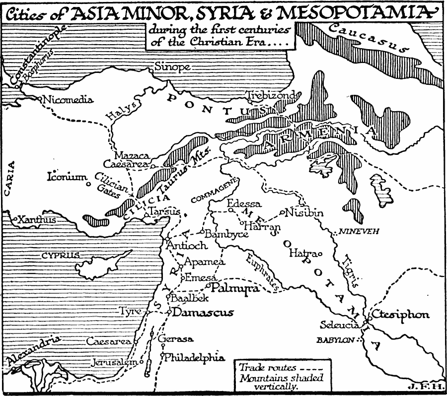
Description: A map of Asia Minor, Syria, and Mesopotamia showing important historical cities, trade centers, ports, and trade routes of the region during the first centuries of the Christian era. The map shows the river and mountain systems in the region, and the important passes of the trade routes, including the Cilician Gates across the Taurus Mountains. The important trade ports of the area are shown, including Alexandria at the mouth of the Nile, Caesarea, Tyre, Antioch, Tarsus, and Xanthus along the Mediterranean, and Constantinople and Trebizond on the Black Sea. Important inland trade centers include Ctesiphon on the Tigris River, Damascus, and Palmyra.
Place Names: Southwest Asia, Mesopotamia, �Armenia, �Pontus, �Syri
ISO Topic Categories: transportation,
location,
oceans,
inlandWaters
Keywords: Historic Cities of Asia Minor, Syria, and Mesopotamia, physical, �transportation, physical features, roads, transportation,
location,
oceans,
inlandWaters, Unknown, 1921
Source: H. G. Wells, The Outline of History (New York, NY: The Macmillan Company, 1921) 543
Map Credit: Courtesy the private collection of Roy Winkelman |
|