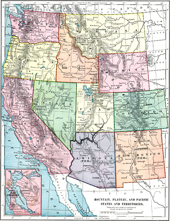
Description: A map from 1899 of the Mountain, Plateau, and Pacific States and Territories (Washington, Oregon, Idaho, Montana, Wyoming, Nevada, Utah, Colorado, California, Arizona Territory, and New Mexico Territory) showing State and Territorial capitals, major cities (names of cities with populations over 50,000 are underlined), towns, mountains, lakes, rivers, and coastal features of the region. The inset map details the vicinity of San Francisco Bay. The national parks of Yellowstone, Yosemite, and Sequoia are shown.
Place Names: Western States, California, �Colorado, �Idaho, �Montana, �Nevada, �New Mexico, �Washington, �Wyoming, ��West Coast, �Washington State, �Rocky Mountain Region, �Pacific State
ISO Topic Categories: oceans,
inlandWaters,
location,
boundaries,
transportation
Keywords: Mountain, Plateau, and Pacific States and Territories, borders, �physical,�population, �topographical, �statistical, physical features,
topographical, country borders, population, oceans,
inlandWaters,
location,
boundaries,
transportation, Unknown, 1899
Source: Horace S. Tarbell, LL.D. , The Complete Geography (New York, NY: American Book Company, 1899) 55
Map Credit: Courtesy the private collection of Roy Winkelman |
|