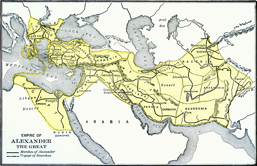
Description: A map of the empire of Alexander the Great at the time of his death (323 BC), showing the extent of the empire from Macedonia in Europe to the Indus River, and including Syria and Egypt. The map shows the satrap boundaries of the Persian Empire, the route of Alexander during his conquest of Egypt and the Persian Empire, and the naval route of Nearchus from the Indus River to the Persian Gulf.
Place Names: Regional Miscellaneous, Africa, �Asia, �Europ
ISO Topic Categories: political, �physical, �transportation, �historical, �alexander the great, kAlexandertheGreat, kWorldMedSea, kWorldAfroAsia, kWorldEurasia
Keywords: Map of the Empire of Alexander the Great, political, �physical, �transportation, �historical, �alexander the great, kAlexandertheGreat, physical features, major political subdivisions, other military, political, �physical, �transportation, �historical, �alexander the great, kAlexandertheGreat, kWorldMedSea, kWorldAfroAsia, kWorldEurasia, Unknown, 323 BC
Source: George Willis Botsford, Ph. D., A History of Greece (London, : The Macmillan Company, 1912) 316
Map Credit: Courtesy the private collection of Roy Winkelman |
|