Tonomy Hill

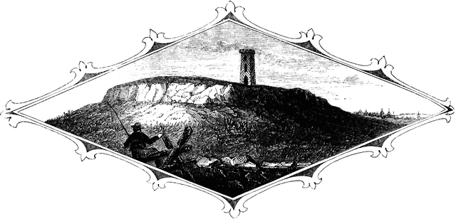
“Top of Tonomy Hill. This view is from the northside of the hill, looking south. The wall appearance is a steep precipice of huge masses of pudding-stone, composed of pebbles and larger smooth stones, ranging in size from a pea to a man’s head. It is a very singular geological formation. In some places the face is smooth, the stones, and pebbles appearing as if they had been cut with a knife while in a pasty or semi-fluid state. On the top of this mound are traces of the breast-works that were thrown up, not high, for the rocks formed a natural rampart, on all sides but one, against an enemy, Here Miantonomoh had his fort, and here his councils were held when he planned his expeditions agains the Mohegans. The observatory is a strong frame covered with lattice-work. On the right is seen the city of Newport in the distance."—Lossing, 1851
Source
Benson J. Lossing, The Pictorial Field-Book of the Revolution (New York: Harper & Brothers, 1851)II:68
Downloads
2400×1156, 792.6 KiB
1024×493, 111.7 KiB
640×308, 47.8 KiB
320×154, 14.2 KiB