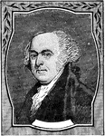
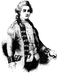
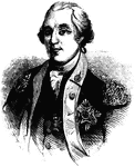
John Adams
An illustration of John Adams who proposed Washington for Commander-in-Chief of the Continental Army.…
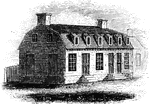
Agnew and Erskine
Head-quarters of Agnew and Erskine. This house is on the south bank of Still River, at the north end…
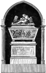
John André's Monument
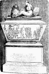
Major John André's monument in Westminster Abbey. André was executed as a spy by Americans in 1780.…
Andre's Execution
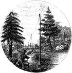
"Place of execution. The place of Andre's execution is now designated by a stone, lying on the right…
Monument to Andre
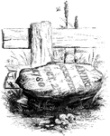
A monument to mark the spot of the site where the British spy Andre was hanged and buried in 1780.
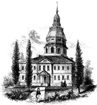
Annapolis State House
"The State House in Annapolis. This fine building is situated upon an elevation in the center of the…
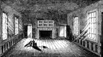
Apollo Room
"The Apollo Room. The room used for public meetings is in the rear building of the old Raleigh tavern…
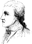
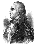
John Armstrong
(1755-1816) Explorer and soldier who was a militia officer in the American revolution.
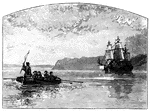
Arnold Landing-place
"View of the landing-place of Arnold. This sketch is from the west side of the cove in which the troops…
Arnold Wounded
Place where Arnold was wounded. This view is in a narrow alley near the north end of Sault au Matelot…
Arnold's Battle
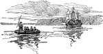
Scene of Arnold's naval battle. This sketch was made from the pilot's room of the steam-boat just after…
Arnold's Escape
A depiction of Benedict Arnold's escape after it has been discovered by American troops that he is a…
Arnold's residence
Arnold's residence. Arnold lived in Water Street, near the ship-yard. The house is still standing (1848),…
Frederic William Augustus, Baron de Steuben
(--) European volunteer to the Continental Army to fight in the Revolutionary War
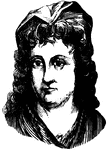
Sarah Bache
(1744-1808) Provided relief to American soldiers in the revolution. Daughter of Benjamin Franklin.
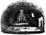
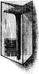
Bakery
The bakery. Near the southeastern angle of the range of barracks is the bakery; it is an under-ground…
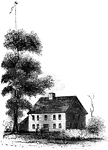
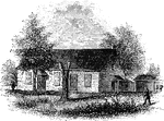
Barrett's House
"Colonel Barrett's House. This sketch is from the road leading to the village of Concord by the way…
Bastile Key
"Key of the Bastile. This key of the old Paris prison known as the Bastile, was sent by La Fayette to…
Battleground near Fort Anne
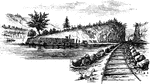
Battleground near Fort Anne. This sketch was taken from the rail-road, looking north. The forest upon…
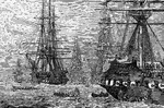
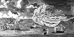
The British Fleet in the Lower Bay
"There were thirty-seven men-of-war, and more than four hundred transport ships, besides the boats.…
Beloeil Mountain
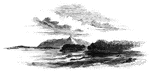
Beloeil Mountain, this sketch is taken from the southeast angle of old Fort chambly, showing the rapids…
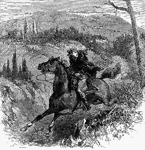
Escape of Benedict Arnold
Benedict Arnold escaping capture by George Washington's forces on the Hudson River.
Bennington Battle-ground
The Bennington battle-ground. This view is from the hill on the southwest bank of the Walloomscoick,…
Battle of Bennington
A battle of the American Revolution, led by General John Stark. The defeat of the British army reduced…
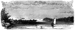
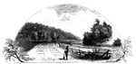
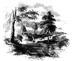
Beverly Dock
"View at Beverly Dock. This view is taken from the Hudson River rail-road, looking north. The dock,…
Birmingham Meeting-House
"Birmingham Meeting-house. This is a view of the southerly front of the meeting-house. The building…
Bloody Pond
Bloody Pond. Tradition avers that for many years its waters bore a bloody hue, and it has ever since…
Bloody Run
Bloody Run, a stream which comes leaping in sparkling cascades from the hills, and affords fine trout…
Boone's Fort
"Boone's Fort. This sketch is from a drawing by Colonel Henderson, and published in Collin's Historical…
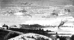
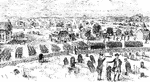
Boston
"View of Boston from Dorchester Heights in 1774. This picture is from an English print of the time.…
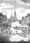
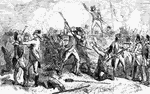
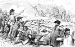
Boston Massacre
"The Boston Massacre, from an engraving by Paul Revere. The Boston Massacre occurred on March 5, 1770."—E.…
Casting Tea Overboard in Boston Harbor
The Boston Tea Party was an act of direct action protest by the American colonists against the British…
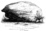
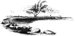
Brant's Rock
Brant's Rock. This rock, which is about four feet high, lies in a field on the left of the road leading…
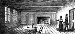
Breakfast Room
"The Breakfast Room. This is a view of the room in the Robinson House in which Arnold was at breakfast…
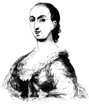
Rebecca Brewton
(--1815) American Patriot who helped troops in South Carolina during the Revolutionary War.
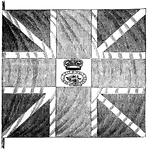
British Flag
"British flag. This is a representation of one of the flags surrendered at Yorktown, and presented to…

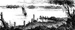
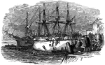
British Surrender
View of the place where the British laid down their arms. The sketch here presented, of the place where…
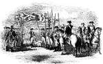
British Troops on Concord Common
"1. Companies of the Regulars marching into Concord. 2. Companies of the Regulars drawn up in order.…
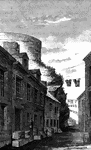
Broadway
"View at the foot of Broadway. General Charles Lee's troops marched to New York."—Lossing, 1851
Bronx
"Place where the British crossed the Bronx. This view is from the southeastern side of the Bronx, a…
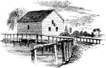
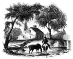
Brower's Mill
"Brower's Mill. This is a view of the old mill of the Revolution, as it appeared when I made the sketch…
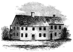
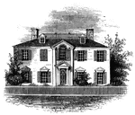
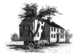
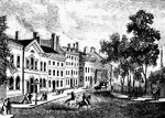
Buckley House
The Buckley House. This building stood upon the eastern side of the Green, fronting the church. It was…
Bunker Hill
A battle of the American Revolution named after the adjacent hill, which was the objective of both colonial…
Bunker Hill After the Battle
"This picture was drawn by a British engineer a few days after the battle. The view is from the north…
Bunker Hill Battle
"Bunker Hill Battle, on June 16th, 1775 during the American Revolution."—E. Benjamin Andrews,…
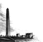
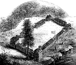
Bunker Hill Monument
"Bunker Hill Monument. This monument stands in the center of the grounds included within the breast-works…