Upper Floridan Aquifer
| View Cart ⇗ | Info

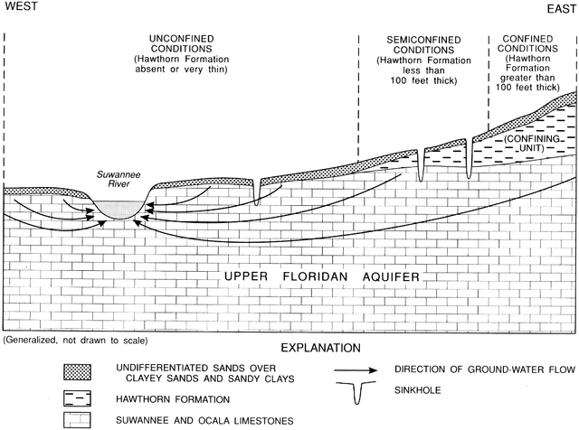
“Generalized schematic of the hydrogeology of the study area. 1, unconfined conditions (Hawthorn Formation absent or very thin); 2, semiconfined conditions (Hawthorn Formation less than 100 feet thick); 3, confined conditions (Hawthorn Formation greater than 100 feet thick).” -Hatzell, 1995
Keywords
geology, limestone layers, geological layers, Hawthorn formation, hydrogeology, upper floridan aquifer, north Florida geology report, geological survey, unconfined conditions, semiconfined, confined conditions, Suwannee river geology, clay layers, Ocala geologyGalleries
HydrologySource
Hatzell, Hilda H. Effects of Waste-Disposal Practices on Ground-Water Quality at Five Poultry (Broiler) Farms in North-Central Florida, 1992-93 (Tallahassee, FL: Florida Department of Environmental Protection, 1995)
Downloads
2400×1785, 591.9 KiB
1024×761, 100.0 KiB
640×476, 51.6 KiB
320×238, 17.6 KiB