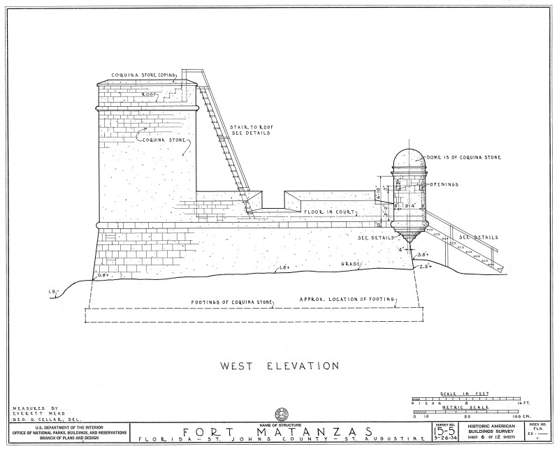
1934 Survey of Fort Matanzas, West Elevation, No. 15-5, US Department of the Interior, Office of National Parks, Sheet 6 of 12.
This is a 1934 architectural design of the west elevation of Fort Matanzas. The plan specifies the structure be built with coquina stone including the dome of the garita (sentry box) and includes the dimensions of the sentry box and openings. The stairs on the first floor (gundeck) are used for accessing the observation deck (roof). Plans produced by the Historic American Buildings Survey, U.S. Department of the Interior, National Park Services, Branch of Plans and Design. Survey No. 15-5, Sheet 6 of 12.Galleries:Fort Matanzas Architectural Drawings, Forts and Fortifications, St. JohnsKeywords:Fort Matanzas National Park, Forts, National Monument, Saint Augustine, Spanish fort, St. Augustine, St. Johns County, elevation, surveyPhoto Location: Fort Matanzas National Monument, St. Johns County, FloridaPhotographer: George G. CellarDate of Photo: 04/15/1934Original Dimensions: 6000×4851Picture Orientation: LandscapeGPS Coordinates: 29°42′55″N 81°14′21″WPicture Number: 26674
WARNING: You are about to download a 1.7 MB TIFF!
Normally such a large file is only needed for high quality printing purposes. If you are certain that you need such a large file, click the DOWNLOAD button to begin.
If you do not wish to download the large TIFF, just click the × in the top right-hand corner to close this alert.