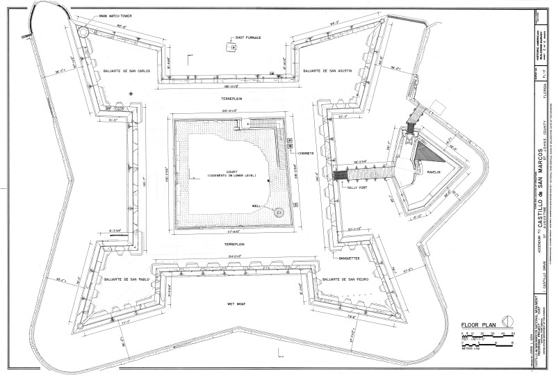
Plan Drawing of Castillo de San Marcos Upper Deck, 1987
The Castillo de San Marcos was renamed Fort Marion after the United States acquired Florida from Spain in 1821. In 1942, Congress restored the original name.
Drawn 1987 by Michael T. Webb as a part of the Historic American Buildings Survey. Drawing was downloaded from the Library of Congress Prints and Photographs Division Washington, D.C. and photo edited by the Florida Center for Instructional Technology.
WARNING: You are about to download a 2.1 MB TIFF!
Normally such a large file is only needed for high quality printing purposes. If you are certain that you need such a large file, click the DOWNLOAD button to begin.
If you do not wish to download the large TIFF, just click the × in the top right-hand corner to close this alert.