|
|
|
| Maps > Europe > Greece |
Historic and contemporary maps of Greece and Hellas, including political and physical maps, early empires, city plans, and battle plans.
|
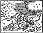
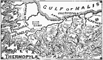
Plan of Thermopylae,
480 BC |
|
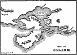
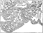
Map of Salamis,
480 BC |
|
Invasion of Greece by Xerxes,
480 BC |
|
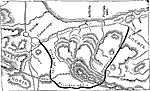
Thermopylae,
480 BC |
|
Battle of Salamis,
480 BC |
|
Thermopylae,
480 BC |
|
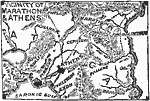
Marathon and Athens,
490 BC |
|
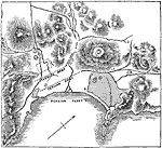
Battle of Marathon,
491 B.C. |
|
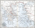
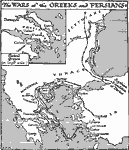
The Wars of the Greeks and Persians,
499–448 BC |
|
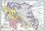
Greece and War with Persia,
499–479 BC |
| First | Previous | Next | Last |
| Maps > Europe > Greece |
Maps ETC is a part of the Educational Technology Clearinghouse
Produced by the Florida Center for Instructional Technology © 2009
College of Education, University of South Florida