|
|
|
| Maps > Asia > India |
Historic and contemporary maps of India, including political and physical maps, pre-colonial and colonial maps, climate maps, and battle plans.
|
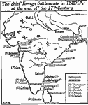
Chief Foreign Settlements in India,
1650–1700 |
|
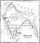
British India,
1744–1774 |
|
India at the beginning of British East India Control,
1750 |
|
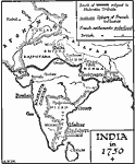
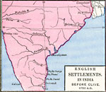
Anglo-India before Robert Clive,
1750 |
|
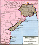
Anglo-India after Clive's departure ,
1760 |
|
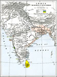
India,
1783 |
|
India at the close of the Government of Warren Hastings,
1785 |
|
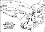
Battle of Seringapatam,
1792 |
|
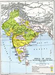
India,
1792–1804 |
|
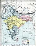
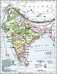
India after the Second Anglo–Maratha War,
1804 |
| Next | Last |
| Maps > Asia > India |
Maps ETC is a part of the Educational Technology Clearinghouse
Produced by the Florida Center for Instructional Technology © 2009
College of Education, University of South Florida