|
|
|
| Maps > Asia > Regional Maps >Miscellaneous Regional Maps of Asia |
Regional Asian maps of the Miscellaneous Regional Maps of Asia region from the Maps ETC collection. This includes physical and political maps, early history and empires, climate maps, relief maps, population density and distribution maps, cultural maps, and economic/resource maps.
|
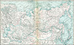
Northern Asia embracing Siberia, Mongolia and Japan,
1920 |
|
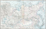
Northern Asia,
1920 |
|
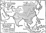
Spread of Buddhism,
1921 |
|
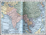
Central and Southern Asia,
1922 |
|
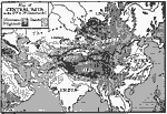
Terrain of Central Asia,
200–1 BC |
|
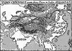
Yuan Chwang's Route from China to India,
629–645 AD |
|
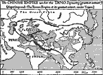
The Tang Empire,
AD 618 to 907 |
|
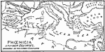
Phoenicia,
Ancient Phoenicia |
|
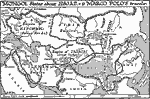
Mongol States ,
Around 1280 |
| First | Previous |
| Maps > Asia > Regional Maps >Miscellaneous Regional Maps of Asia |
Maps
is a part of the
Educational Technology Clearinghouse
Produced by the
Florida Center for Instructional Technology
© 2009
College of Education
,
University of South Florida