|
|
|
| Maps > Globes and Multi-continent > Complete Maps |
A collection of world and multi-continent maps, including various projections, hemispheric maps, physical and political maps, early known world maps, climate maps, relief maps, ocean current maps, population density and distribution maps, vegetation maps, and economic/resource maps.
|
Schöner's Globe,
1523 |
|
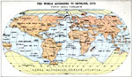
The World According to Ortelius,
1570 |
|
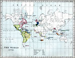
The World,
1772 |
|
The British Empire in 1815,
1815 |
|
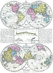
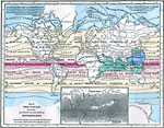
Map of the World on an Equatorial Projection and Polar Projection,
1838–1842 |
|
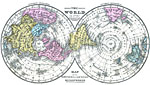
Map of the World on a Polar Projection,
1840–1841 |
|
Map of the World illustrating the principal features of the land and the co-tidal lines,
1855 |
|
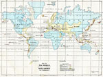
Map of the World showing the distribution of Volcanoes and Earthquakes,
1868 |
|
Map of the World showing the principal Ocean Currents and boundaries of River Systems,
1868 |
|
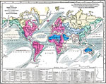
Map of the World illustrating the Principal Features of Meteorology,
1868 |
| First | Previous | Next | Last |
| Maps > Globes and Multi-continent > Complete Maps |
Maps ETC is a part of the Educational Technology Clearinghouse
Produced by the Florida Center for Instructional Technology © 2009
College of Education, University of South Florida