Maps Site map
  Maps > Globes and Multi-continent > Complete Maps
Site Map  

  Record   21   to   30  of   316

A collection of world and multi-continent maps, including various projections, hemispheric maps, physical and political maps, early known world maps, climate maps, relief maps, ocean current maps, population density and distribution maps, vegetation maps, and economic/resource maps.

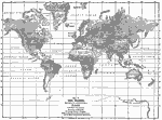
Map of the World illustrating the relative amount of Rain or Melted Snow and Ice deposited on the Lands, 1868
A map from 1868 of the world, showing the relative annual deposit of rainfall, snow, and ice on the land surfaces. The map is shaded to show the proportional quantity of rain, snow and ice in the regions, with the figures indicating the annual depth ...

Map of the World showing the Distribution and Limits of Cultivation of Primitive Plants useful to Mankind, 1868
A map from 1868 of the world, showing the distribution and limits of cultivation of the principal plants useful to mankind. This map shows the northern and southern limits of trees and palms, the limits of grains such as wheat, rice, barley, rye, oat...

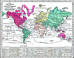
Map of the World showing the distribution of the Principal Races and Varieties of Mankind, 1868
A map from 1868 of the world, showing the distribution of the principal races and varieties of mankind as accepted at the time. The map is color–coded to show the areas where the predominant populations are European, Mongolian, American Native,...

Map of the World Illustrating Industry, Commerce, and Navigation, 1868
A map from 1868 of the world, showing the primary productive industries of various countries, and the principal ship routes between major ports. The map shows the mineral fishery, fur, and agricultural resources in Asia, Europe, Africa, North and Sou...

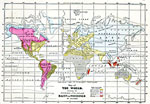
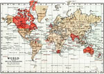
The World showing British Possessions and Dependencies., 1871
This is a map of The World from 1871 showing British Possessions and Dependencies. This map shows continents, countries, major cities of the time, major river ways and political boundaries. The British possessions are colored red with the names of sm...

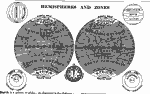
Hemispheres and Zones of the Earth, 1872
A double hemisphere map of the earth from 1872 showing the world displayed in western and eastern hemispheres. This mapping convention of dividing the earth, bound by the 20° W and 160° E meridians, shows the "Old World" and "N...

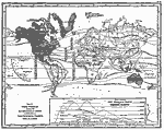
Ocean Currents, Temperature Zones, and Drainage Basins of the World, 1872
A world map on Mercator's Projection from 1872 "which shows plainly the relative directions and positions of the Oceans, Oceanic Currents, Continents, Islands, etc." and includes temperature zones and drainage basins of the earth. The map s...

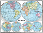
Hemispheric Representations of the Earth, 1872
A double hemisphere map of the earth from 1872 showing the world displayed in western and eastern hemispheres. This mapping convention of dividing the earth, bound by the 20° W and 160° E meridians, shows the "Old World" and "N...

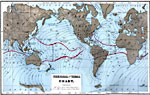
Commerce and Trade World Map, 1872
A world map from 1872 showing trade routes by steamship, sailing vessel, and railway, and primary exports for various countries at the time. Red lines on water show steamer routes, brown lines show sailing routes, red lines on land show railroads, bl...

Thermal and Tidal Chart, 1873
A map of the world from 1873 showing ocean tides and temperature ranges. The map shows mean surface temperatures in parentheses, given in degrees Fahrenheit, and indicates the boundaries of the Warm Water Belt where surface waters have a mean tempera...

First Previous Next Last


  Maps > Globes and Multi-continent > Complete Maps
Site Map  

Maps ETC is a part of the Educational Technology Clearinghouse
Produced by the Florida Center for Instructional Technology © 2009
College of Education, University of South Florida