|
|
|
| Maps > Globes & Multi-Continent > Regional Maps >Regional Mediterranean |
Regional Globes & Multi-Continental maps of the Regional Mediterranean region from the Maps ETC collection. This may include physical and political maps, early history and empires, climate maps, relief maps, vegetation maps, population density and distribution maps, cultural maps, and economic/resource maps.
|
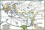
Greek Conquest of the Aegean World and the Spread of Phoenician Commerce,
1500 BC |

|
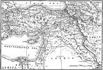
Pre–Greek Civilization in the Eastern Mediterranean World,
1500 BC |
|
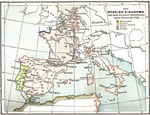
The Spanish Kingdoms and their European dependencies under Charles the Fifth,
1556 |
|
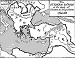
Ottoman Empire at the Death of Suleiman the Magnificent,
1566 |
|
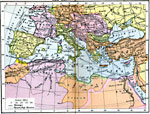
The Mediterranean Sea,
1801–1815 |

|
Biblical Egypt, Sinai and Canaan,
1893 |

|
Turkey of the Future,
1914 |
|
Outline Map of the World's Most Historic Lands,
1916 |
|
Mediterranean Sea,
1920 |
|
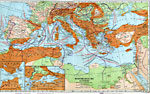
Economic and Commercial Map of the Mediterranean Sea Countries,
1920 |
| First | Previous | Next | Last |
| Maps > Globes & Multi-Continent > Regional Maps >Regional Mediterranean |
Maps
is a part of the
Educational Technology Clearinghouse
Produced by the
Florida Center for Instructional Technology
© 2009
College of Education
,
University of South Florida