Maps Site map
  Maps > Globes & Multi-Continent > Regional Maps >Regional Eurasia
Site Map  

  Record   11   to   17  of   17

Regional Globes & Multi-Continental maps of the Regional Eurasia region from the Maps ETC collection. This may include physical and political maps, early history and empires, climate maps, relief maps, vegetation maps, population density and distribution maps, cultural maps, and economic/resource maps.
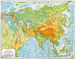
Physical Map of Eurasia, 1901
A geophysical map of Eurasia from 1901 showing general elevations of landforms and submerges continental plateau. The map is color–coded to show highlands above 2000 feet in buff tints, lowlands in green tints, lands below sea level in purple, ...

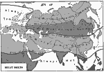
Eurasian Heat Belts, 1901
A map from 1901 showing the heat belts in Eurasia. The map uses isotherm lines to show regions where the climate is always temperate, regions of cold winters and temperate summers, cold winters and hot summers, temperate winters and hot summers, and ...

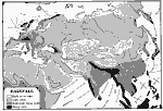
Eurasian Rainfall Distribution, 1901
A map from 1901 showing mean annual rainfall in Eurasia. The map shows areas where little or no rainfall occurs, regions of little rain, moderate to heavy rainfall, and regions of heavy rainfall. The map also shows prevailing seasonal coastal wind di...

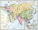
Eurasia, 1901
A map from 1901 of Eurasia, showing the political boundaries at the time, foreign possessions, capitals and major cities, railways, mountain systems, lakes, rivers, coastal features, and islands of the region. The map shows the extent of the German, ...

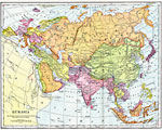
Eurasia, 1902
Map of Eurasia....

Russia's Great Railway Links, 1919
A map of Eurasia in 1919 showing Russia's Trans–Siberian railway system from the Pacific port of Vladivostok to Moscow and the Baltic Sea port of Petrograd. The map shows the Russian link to railway network of Europe, Asia Minor, Arabia, Turkes...

Conditions of Life during the Historic Period in Asia, 800 B.C.
A map of Asia and Eastern Europe illustrating the homelands of the Asiatic and Semitic nomads, and general conditions of life during the historical period. The map is hatchure-keyed to show regions of mountains and highlands shaded vertically, tundra...

First Previous


  Maps > Globes & Multi-Continent > Regional Maps >Regional Eurasia
Site Map  

Maps is a part of the Educational Technology Clearinghouse
Produced by the Florida Center for Instructional Technology © 2009
College of Education , University of South Florida