|
|
|
| Maps > Globes & Multi-Continent > Regional Maps >Regional Miscellaneous |
Regional Globes & Multi-Continental maps of the Regional Miscellaneous region from the Maps ETC collection. This may include physical and political maps, early history and empires, climate maps, relief maps, vegetation maps, population density and distribution maps, cultural maps, and economic/resource maps.
|
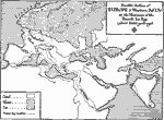
Europe in the Fourth Ice Age,
50,000 B.C. |
|
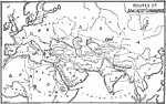
Routes of Ancient Commerce,
500 BC |
|
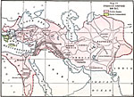
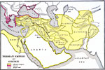
Persian Empire,
500 BCE |
|
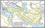
Persian Empire under Darius,
522–486 BC |
|
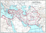
Persian Empire,
550 B.C. to A.D. 1037 |
|
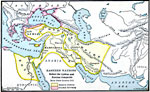
Eastern Nations Before the Lydian and Persian Conquests,
560 BC |
|
Persian Empire and Greece,
560–490 B.C. |
|
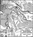
The Cradle of Western Civilization,
6,000 to 4,000 BC |
|
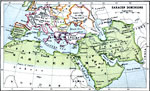
Saracen Dominions,
622–1492 |
|
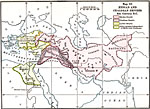
Median and Chaldean Empires,
6th Century BCE |
| First | Previous | Next | Last |
| Maps > Globes & Multi-Continent > Regional Maps >Regional Miscellaneous |
Maps
is a part of the
Educational Technology Clearinghouse
Produced by the
Florida Center for Instructional Technology
© 2009
College of Education
,
University of South Florida