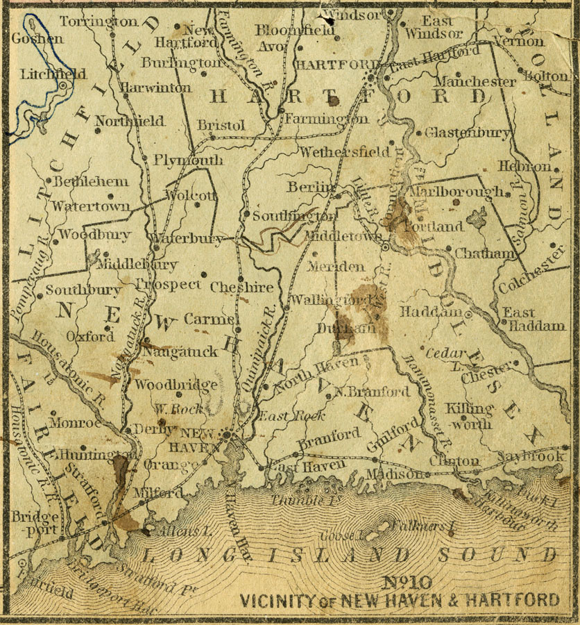
Description: A map from 1858 of the vicinity of Hartford on the Connecticut River. The map covers central Connecticut from Hartford south to New Haven, Litchfield to Bolton, and the Long Island Sound coastline from Fairfield to Saybrook.
Place Names: Connecticut, Hartford, �New Haven, �Bridgeport, �Derby, �Meriden, �Middletow
ISO Topic Categories: inlandWaters,
location,
oceans,
transportation,
boundaries
Keywords: Vicinity of New Haven and Hartford, political, �transportation, �physical, physical features, county borders, railroads, inlandWaters,
location,
oceans,
transportation,
boundaries, Unknown, 1858
Source: , Mitchell's School Atlas (Philadelphia, PA : E. H. Butler & Co., 1863)
Map Credit: Courtesy the private collection of Roy Winkelman |
|