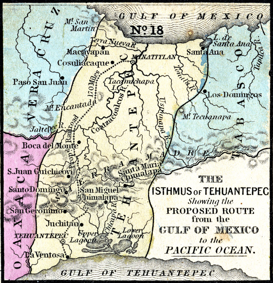
Description: A map from 1852 of the Isthmus of Tehuantepec in Mexico, showing the proposed railroad route connecting the Gulf of Mexico and the Pacific. This was an alternative proposal to the construction of the Panama or Nicaragua canals, and was favored by some due to the shorter shipping distances, however funds were approved by congress for the Panama Canal project, and the Tehuantepec route was abandoned by the United States. The project was undertaken by the Mexican government, and completed in 1907.
Place Names: Mexico, Veracruz, �Tehuantepec, San Miguel Chimalapa, Santa Ana, Juchitan, San Geronim
ISO Topic Categories: boundaries,
inlandWaters,
location,
oceans,
transportation
Keywords: The Isthmus of Tehuantepec, physical, physical features, major political subdivisions, railroads,
water routes, boundaries,
inlandWaters,
location,
oceans,
transportation, Unknown, 1852
Source: , Mitchell's School Atlas (Philadelphia, PA : E. H. Butler & Co., 1863)
Map Credit: Courtesy the private collection of Roy Winkelman |
|